Utility Survey vs Drainage Survey: What Is the Difference?
A utility survey finds and maps buried services before digging. A drainage survey goes inside the drains to trace, measure and grade them. Here is how they differ, where utility surveys miss drains, and which one your job needs.
A utility survey locates and maps every buried service on a site (electricity, gas, water, telecoms and drainage) so nobody hits one when digging. A drainage survey looks only at the drains, but in far more depth: where they run, how deep they are, which way they fall and what condition they are in. Which one you need depends on whether your question is "what is under here?" or "what is wrong with this drain?"
What is a utility survey?
A utility survey is a search for buried services using detection equipment, carried out before excavation, piling or design work. In the UK, the standard for it is PAS 128, which sets out how the survey is done and how confident the results can be said to be.
The main tools are electromagnetic locators, which pick up metal cables and pipes or a signal put onto them, and ground penetrating radar (GPR), which can detect non-metallic pipes and voids by bouncing radar pulses off changes in the ground. The surveyor also lifts covers, reads the utility companies' own records, and marks findings on the ground and on a plan.
PAS 128 separates the work into survey types, from a desktop search of records, through a site reconnaissance, to detection with equipment, up to verification by physically exposing the service in a trial hole or with vacuum excavation. Each service on the final drawing carries a quality level that tells the designer how much to trust its position. That grading is the reason utility surveys are specified on construction projects: a line on a plan is only useful if you know whether it was measured or guessed.
What is a drainage survey?
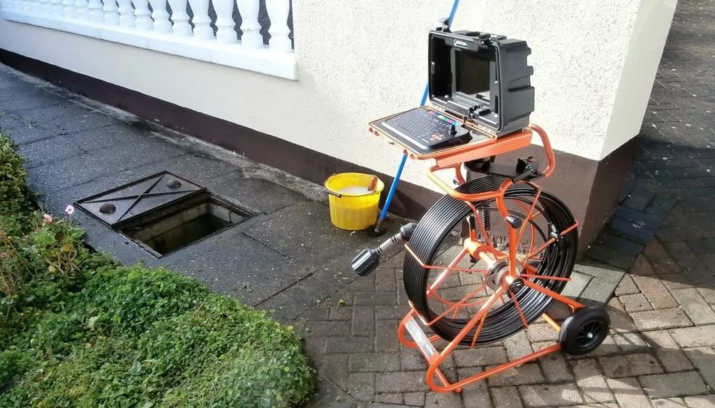
A drainage survey investigates the drains themselves, from inside the pipe. A camera is pushed or driven through each run between access points, the pipe's route is traced from the surface, and the surveyor records the depth, size, material, direction of flow and every defect along the way.
The output is a coded report: each defect is logged by its distance from the access point, described in a standard format and graded, usually alongside a plan of the drainage layout. Our guide to the different types of drainage survey explains how a condition survey, a tracing survey and a level survey differ, if you need to narrow it down further.
Why a utility survey often misses drains
Most private drains in London are clay or plastic, carry no current, and lie at shallow depths in mixed made ground. Electromagnetic locators cannot detect them directly, and GPR results in wet clay and old rubble fill can be patchy.
This is the gap that catches people out. A utility survey will usually show the drains that can be seen at a manhole or gully, joined up with straight lines, and those lines are often marked at a lower quality level. It will not normally tell you that a run bends under the extension, that an unrecorded branch comes in from next door, or that the pipe you are about to build over is cracked. Unless the specification asks for it, the surveyor is not expected to put a camera in the pipes.
The reliable way to locate a non-metallic drain is to send something down it that can be detected. A sonde, a small transmitter pushed along the pipe on a rod or camera, lets the pipe's route and depth be plotted from the surface, point by point. That is the core of drain tracing, and it is why good utility surveyors either bring in a drainage specialist or include CCTV and sonde work in their scope.
Which one do you need?
For most domestic work, you need the drainage survey, plus a basic cable and pipe scan before digging. A full PAS 128 utility survey is usually for commercial sites, road and footway work, piling, and projects where a designer or principal contractor has specified one.
| Situation | What usually fits |
|---|---|
| Rear extension near an existing drain or sewer | Drainage survey (CCTV and tracing), plus a cable and pipe scan before excavation |
| Recurring blockage, smell or leak | Drainage survey only |
| Buying a house | Drainage survey only |
| New-build plot, basement dig or piling | Utility survey to PAS 128, with a drainage survey for the drains |
| Commercial refurbishment or car park resurfacing | Utility survey, with CCTV of drains that are being kept |
If you are building over or close to a shared sewer, the water company will want drainage evidence specifically, not a utility plan. Our article on build over agreements and the CCTV surveys they need covers what that evidence looks like.
Can one company do both?
Sometimes, but check what is actually included. Some utility survey firms carry out CCTV drainage work in-house; others subcontract it or leave it out. Some drainage contractors trace and map drains to a high standard but do not offer PAS 128 detection of cables and gas mains.
Our work is on the drainage side: CCTV surveys, drain tracing and written reports on the drains. If your project needs a PAS 128 survey of electricity, gas or telecoms services, commission a specialist utility surveyor and ask them how the drainage part will be done. Where the two surveys are separate, ask for both to use the same reference points and chamber numbers, so the drawings can be combined without anyone redrawing the drains.
Getting the scope right before anyone arrives
Most disappointing surveys are not badly done. They answer a different question from the one the client had. Before booking either survey, write down in a sentence what you need to know, and make sure the quote answers it.
- If you need to know where it is safe to dig, a utility survey or cable scan is the tool.
- If you need to know where a drain runs and how deep it is, ask for drain tracing with a sonde, not a GPR sweep alone.
- If you need to know whether a drain is damaged, ask for a CCTV condition survey with a coded, graded report.
- If a designer, insurer or water company has asked for the survey, send the quote to them to confirm it meets their requirement before the work is done.
If you are not sure which of these applies to your job, a short description of the work and the site is usually enough for us to say whether a drainage survey will answer it, or whether you need a utility surveyor instead. Our CCTV drain survey page sets out what our reports contain.
Frequently asked questions
Does a utility survey include drains?
Usually only at a basic level. A utility survey records drains visible at manholes and gullies and joins them up on a plan, but plastic and clay drains are hard to detect with locators and radar. Unless the specification includes CCTV and sonde tracing, the drains' exact route, depth and condition are not normally confirmed.
What is PAS 128?
PAS 128 is the UK specification for detecting, verifying and mapping underground utilities. It sets out survey types, from a desktop search of records to verification by trial holes, and gives each mapped service a quality level so designers know how much to rely on its recorded position.
Can ground penetrating radar find drains?
Sometimes. GPR can detect non-metallic pipes, but results in wet clay and rubble fill are often patchy. The dependable way to locate a drain is to push a sonde through it and plot its route and depth from the surface, which is what drain tracing does.