Drainage Level Survey: Invert Levels, Falls and When You Need One
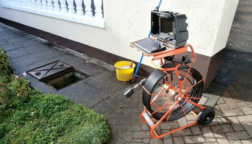
A drainage level survey records how deep your drains are and how much they fall between chambers. Designers, building control and water companies often need those figures. For a blocked drain, you rarely do.
A drainage level survey measures the height of each chamber cover and the invert, the lowest inside point of the pipe or channel, at every chamber on a drainage system. From those two figures you get the depth of the drain at each point and the fall of every run between chambers. It is the survey an architect or engineer needs before connecting new drainage to old, and it answers a different question from a CCTV condition survey.
What does a drainage level survey measure?
It measures cover level and invert level at each chamber, relative to a fixed reference point, and the length of pipe between them. Everything else in the survey is worked out from those three measurements.
- Cover level (CL): the height of the top of the chamber cover.
- Invert level (IL): the height of the bottom of the inside of the pipe or channel where it enters or leaves the chamber.
- Depth to invert: cover level minus invert level, which tells a builder how far down the pipe is.
- Datum: the reference all levels are measured from. On a small job this is often a site datum, such as a fixed point given an assumed level. On larger jobs levels are tied to Ordnance Datum so they match other drawings and the public sewer records.
A chamber can have more than one invert level. Incoming pipes often enter higher than the outgoing one, and a backdrop, where a pipe drops vertically into the chamber, can make that difference large. A good survey records each pipe separately.
How the fall of a drain is worked out
The fall is the difference between the invert levels at each end of a run, divided into the length of the run, and it is written as a ratio such as 1:80. That means the pipe drops one unit for every 80 units along.
For example, if the outgoing invert at one chamber is 10.50 m, the incoming invert at the next is 10.20 m and the chambers are 24 m apart, the pipe falls 0.30 m over 24 m. Dividing 24 by 0.30 gives 1:80.
For comparison, Approved Document H to the Building Regulations gives minimum gradients for new foul drains. For most house drains the commonly quoted figures are 1:80 for a 100 mm drain serving at least one WC, and 1:150 for a 150 mm drain serving at least five WCs. Older London drains often do not match modern guidance and still work, so a flat run on its own is not proof of a fault. It becomes relevant when it lines up with standing water, silt or repeated blockages.
How a level survey is carried out
The surveyor lifts each cover, measures down to the invert of every pipe, and levels each cover back to the datum with an optical level, a total station or satellite positioning equipment. Pipe lengths come from tracing or from the distance counter on a CCTV camera.
On a typical London house this is a few chambers front and back, and often a shared run behind a terrace. The survey is only as complete as the chambers that can be opened. Covers that are sealed, buried under paving or inside a neighbour's garden leave gaps, and the report should say which chambers were not lifted and how any missing levels were estimated. Where chambers are missing altogether, the route has to be found first, which is where drain mapping comes in.
What the survey gives you
The output is a drainage plan with the levels marked at each chamber, and a chamber schedule listing the figures. The table below shows the kind of schedule to expect. The figures are illustrative, not from a real survey.
| Chamber | Cover level | Invert level | Depth to invert | Outgoing pipe |
|---|---|---|---|---|
| IC1 (rear garden) | 11.35 | 10.50 | 0.85 m | 100 mm to IC2, 1:80 |
| IC2 (side passage) | 11.40 | 10.20 | 1.20 m | 100 mm to IC3, 1:60 |
| IC3 (front garden) | 11.30 | 9.95 | 1.35 m | 100 mm to sewer |
Check that the schedule states the datum, the pipe diameters and directions of flow, and which figures were measured rather than estimated. Without the datum, levels cannot be matched to an architect's drawings or to the water company's sewer records.
Level survey or CCTV survey: which do you need?
A level survey tells you the overall fall between chambers. A CCTV survey tells you the condition inside the pipe, including local sags and back-falls that a level survey between two chambers will miss.
A run can have a healthy overall fall and still hold water in a dip halfway along, because one section has settled. The camera shows that as standing water and records it on the report. Some survey equipment also records pipe inclination, which helps, but chamber levels remain the usual reference for design. The two surveys are often done together. If the question is why a drain keeps blocking or whether a pipe is damaged, start with a CCTV drain survey. If the question is how deep the drains are and whether new pipework can fall into them, you need levels.
When you need a level survey, and when you do not
You need one when new drainage has to connect to existing drainage, or when someone has to design around the drains you have. For a blockage, a smell or a pre-purchase check, you almost never do.
Common reasons to commission levels:
- Extensions and new bathrooms: to confirm new drainage can reach an existing chamber with enough fall, or whether a new chamber is needed.
- Basement conversions: to establish whether waste can drain by gravity at all, or whether it will need a pump.
- Building over or near a sewer: the water company may want depths as well as condition.
- New connections and adoption: sewer connection and adoption applications usually need levels tied to the sewer records.
- Soakaways and surface water: the invert of the outlet sets how deep a soakaway or attenuation tank has to go.
- Persistent ponding or silting: where a CCTV survey suggests a run is too flat along its length rather than dipping in one place.
A homebuyer, or someone with a blocked drain, does not usually need one. A survey with levels takes more time than a condition survey alone, so ask for levels only when someone needs the figures. If you have been asked for a drainage survey and are not sure whether levels are part of it, our overview of the types of drainage survey will help you ask the right question.
Frequently asked questions
What is an invert level in drainage?
The invert level is the height of the lowest point on the inside of a pipe or chamber channel, measured from a fixed datum. Subtracting it from the cover level gives the depth of the drain at that chamber, and comparing invert levels at two chambers gives the fall of the pipe between them.
What fall should a house drain have?
Approved Document H gives minimum gradients for new foul drains. The commonly quoted figures are 1:80 for a 100 mm drain serving at least one WC and 1:150 for a 150 mm drain serving at least five WCs. Many older drains are flatter and still work, so a low fall is only a concern when it matches standing water, silt or repeat blockages.
Does a CCTV drain survey include levels?
Not usually. A standard CCTV survey records the condition of the pipes and may note chamber depths, but a full level survey ties cover and invert levels to a datum so falls can be calculated. If an architect or building control needs levels, ask for them specifically when booking.